Mercer County Emergency Management Changes Tornado Siren Protocol For Storm Season
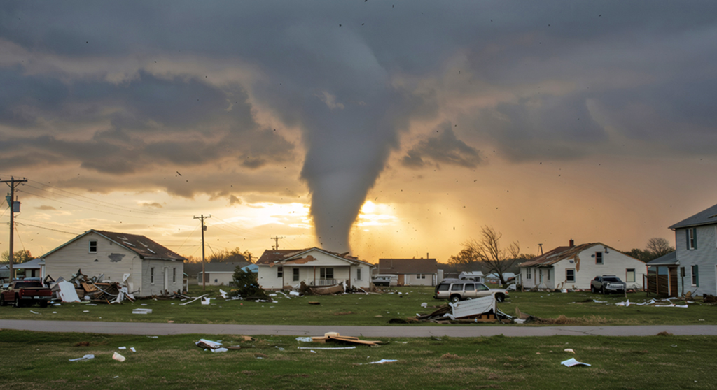
Photo Submitted
Mercer County residents are encouraged to sign up for Hyper-Reach to receive tornado and storm updates during spring severe weather.
April Ellis
Herald Staff
Last week, Mercer County Emergency Management Director Brad Cox announced a change to the tornado siren protocol. The outdoor warning system will now sound only when a tornado warning has been issued or a severe storm capable of destructive winds or a tornado is detected. Cox announced the change at the Harrodsburg City Commission and Mercer County Fiscal Court meetings.
Previously, the sirens were sounded for severe storms and tornadoes. Sirens will be activated during tornado warnings issued by the National Weather Service, which are often based on radar indication of rotation.
Emergency Management officials said the change is intended to reduce public confusion and prevent overuse of the sirens, which are designed strictly as an outdoor warning tool.
“When I started as Emergency Management Director in September 2023, I changed the sounding of the siren to severe thunderstorms thinking we needed the notification for them. A year later, some of the community started complaining on Facebook about the sirens going off all of the time. Last spring I started looking at the pros/cons of the severe thunderstorm siren. I had some really good conversations with members of the public,” Cox said. “I spoke with the County Judge, heads of the Police, Sheriff, EMS and Mercer County and Harrodsburg Fire Departments. I had several meetings with Mike Kochasic, who is with the National weather service out of Louisville. I took the time frame of spring of last year until now to look into this protocol. The biggest problem we face is the inability to tell the difference between the two warnings.”
Cox reminded the public that sirens are meant to warn people outdoors and may not be audible indoors or in all parts of the county, depending on distance and weather conditions.
Residents are encouraged to have multiple ways to receive severe weather warnings, including NOAA Weather Radios, local television and radio stations, and wireless emergency alerts on mobile devices. The Hyper-Reach storm warning system is accessible on mobile devices. The link to sign up for text or voice messages is available on the Mercer County Emergency Management Facebook page or by visiting signup.hyper-reach.com. The Hyper-Reach app is also available for download for iPhones and Android devices. To receive alerts on a smart speaker, say, “Alexa, enable Hyper-Reach.”
Cox emphasized that a tornado warning issued by the National Weather Service should always be taken seriously, even if sirens are not activated.
Cox said they will continue working closely with the National Weather Service and local emergency partners to monitor severe weather and keep residents informed, and encourage residents to review their severe weather safety plans as the spring storm season approaches.
Severe Storm/Tornado Prep
As spring approaches, severe weather season ramps up across Central Kentucky, bringing the potential for tornadoes, damaging winds, large hail and flash flooding.
Emergency officials say preparation before storms strike is the key to staying safe.
Understand the difference: Watch vs. Warning
The National Weather Service issues two primary alerts during severe weather. Tornado watch means conditions are favorable for tornadoes to develop. Stay alert and be ready to take action.
Tornado warnings mean a tornado has been sighted or indicated by radar. Take shelter immediately.
Residents should never wait for visible confirmation of a tornado. If a warning is issued for your area, act immediately.
Multiple ways to receive alerts
Outdoor warning sirens are designed to alert people who are outside. They may not be heard indoors, especially during heavy rain or high winds.
Officials recommend a NOAA weather radio with fresh batteries. Wireless emergency alerts enabled on your cellphone including Hyper-Reach.
Identify your safe place
Every household should have a designated safe area. The safest locations are:
• Basement or storm shelter
• Interior room on the lowest floor
• Small room without windows, such as a bathroom or closet
• Stay away from windows and exterior walls. Cover yourself with a mattress, heavy blankets or a helmet to protect against debris.
• Mobile homes are especially vulnerable during tornadoes. Residents should plan ahead to shelter in a sturdy building if severe weather is forecast.
Build an emergency kit
Keep a basic emergency kit in your safe space that includes:
• Flashlights and extra batteries
• Battery-powered weather radio
• Bottled water
• Nonperishable snacks
• First-aid supplies
• Necessary medications
• Phone chargers or power banks
It’s also wise to keep sturdy shoes nearby in case you need to walk through debris after a storm.
Prepare your property
Before storms arrive:
• Secure or bring inside outdoor furniture and loose items
• Trim weak tree branches
• Clean gutters and drainage areas
• Review your homeowners or renters insurance coverage
• If you live in a flood-prone area, never attempt to drive through flooded roadways. “Turn around, don’t drown” remains the rule of thumb.
Make a family communication plan
Discuss ahead of time how family members will communicate if separated. Choose an out-of-town contact person everyone can check in with. Make sure children understand where to go and what to do during a warning.
Stay weather aware
Severe storms in Kentucky can develop quickly, particularly during afternoon and evening hours. Monitoring forecasts during high-risk days can provide valuable lead time.
Emergency officials stress that preparation should happen long before dark clouds appear.
“Tornadoes can form with little notice,” Cox said. “Having a plan and knowing where to go can make all the difference.”
As severe weather season approaches in Central Kentucky, taking a few simple steps now can help ensure families stay safe when storms roll through.